
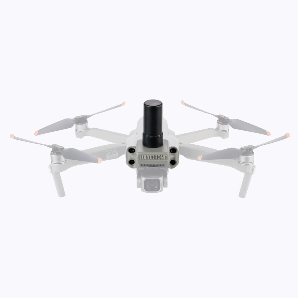
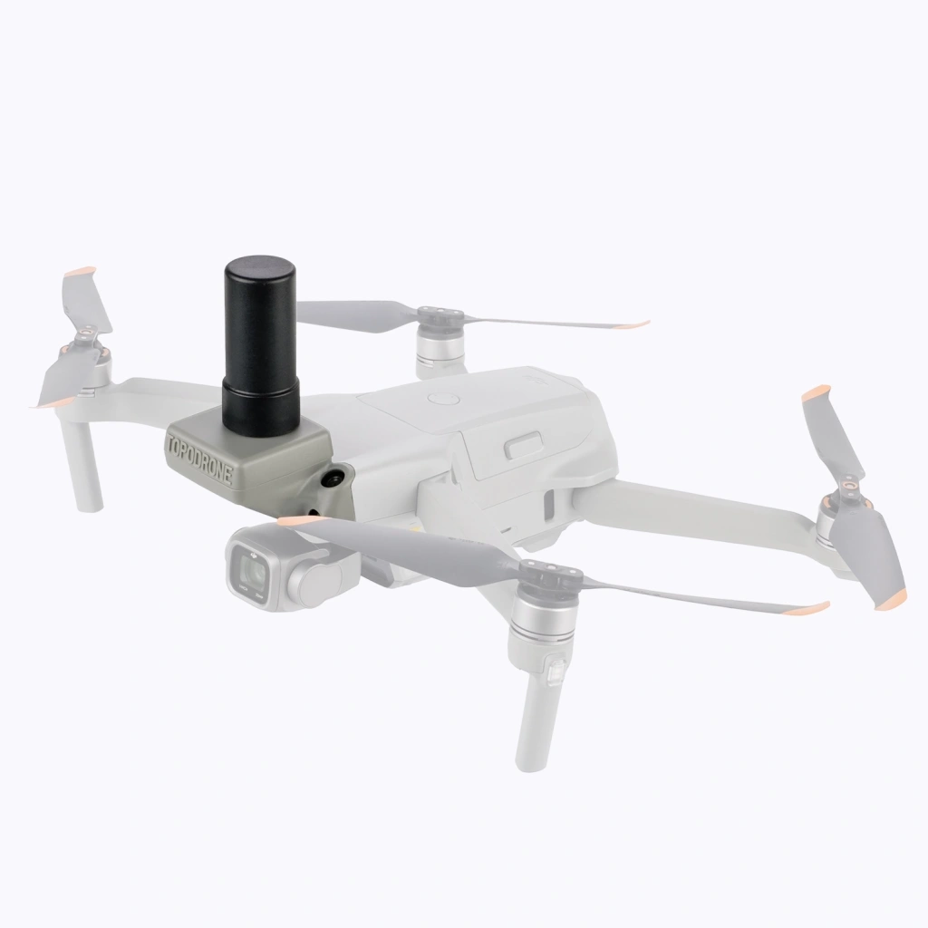
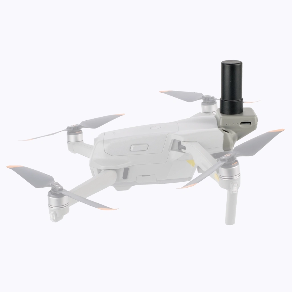
TOPODRONE PPK GNSS module for DJI Air 2S
Features:
1) The Topodrone DJI Air2S PPK is quite compact, being only a bit larger than the Topodrone Mini 2 PPK. It is the optimal solution for surveyors who move the equipment on foot, for example in hard-to-reach places.
2) Despite its compact size, the drone based at 1 inch sensor with 20 megapixel resolution, with a constant aperture of F2.8. These features allow you to take high-quality photos just as good as the most-advanced models.
3) Thanks to a dual set of frontal sensors, Topodrone DJI Air2S PPK is able to detect obstacles even at high angles, such as in strong winds or at high drone’s speed. The Topodrone upgrade does not block the visibility of these sensors.
4) The maximum actual radio control range is 4000 meters**, allowing you to receive telemetry and video stream from the Topodrone DJI Air2S PPK even at a long distance from the takeoff point.
5) Maximum ascend and descend speeds of 6 m/s increase the efficiency of aerial surveying in mountainous terrain.
6) Thanks to the special shape of the propellers and light weight, Topodrone DJI Air2S PPK will be virtually silent at a distance of 50 meters.
7) You get all these advantages with Topodrone PPK technology, which will allow you to get the 3-5 cm accuracy without using reference points.
Description:
Topodrone DJI Air2S PPK is a compact drone for professional highly accurate aerial surveying. With small dimensions and weight, the drone is able to surprise with features, including a 1-inch camera sensor with 20 MP resolution, flight time up to 23 minutes in real weather conditions, as well as the presence of a dual system of visual positioning sensors, working in the forward direction even at high speeds. It is possible to fly a route, including terrain avoidance*.
Topodrone PPK upgrade with GNSS receiver is integrated in DJI Air2S PPK drone to provide shutter events data and record high quality raw GNSS data for future post processing in Topodrone Post Processing software to get high accuracy coordinates of photo centers.
* Mission planning with AMSL or terrain following is available when using third-party software DroneLink or UgCS Expert with route export in .KML format to DroneLink or, respectively Litchi software.
** Measured at open area in direct line of sight, away from radio signal interference sources at 2.4 GHz